Page Navigation
Flooding Information
*** NEW - Flood Certificates ***
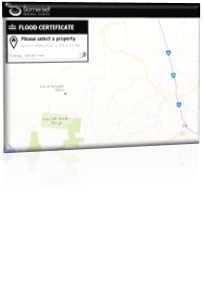
 Council has used existing modelling to develop an online property specific Flood Certificate system which will help give residents a better understanding of their own flood risk. The flood certificates portal can be found here https://waterride.net/Certificates/Somerset/
In areas where modelling has not been performed, Council uses the Queensland floodplain assessment overlay (QFAO) created by the Department of Natural Resources, Mines and Energy (DNRME). Visit https://floodcheck.information.qld.gov.au/ to view the QFAO Rapid Hazard Assessment.
Please note:
- Council makes no warranty or representation regarding the accuracy or completeness of the flood information provided through this service. The use of the service is entirely at the risk of the user.
- Council accepts no responsibility for any error or inaccuracy which may result in you receivingflood information that relates to the wrong property.
- Council will not be liable or responsible on any basis (including negligence) for any expense, loss, damage, cost of liability (indirect or consequential loss) arising from the use (or misuse) of, or reliance on, the information from this service.
- If you have any questions regarding the information contain within the Flood Certificate, please email council at mail@somerset.qld.gov.au
No two floods are the same and can vary depending on the quantity, duration and location of rain falling on our catchments. There are three main types of flooding experienced in the Somerset region.
- River flooding happens when widespread and prolonged rain falls over a river catchment
- Creek flooding happens when intense rain falls over a creek catchment causing the creek levels to rise, which often occurs quickly with limited warning
- Overland flow happens as water travels over the land during heavy rainfall events and generally occurs over a short period of time.
Floods can occur almost anywhere in Queensland and can rise over days, or in minutes in a 'flash flood'. Don't enter floodwater—even water 30cm deep could sweep you off your feet.
After heavy rain in your area…
- Keep informed about weather patterns and weather forecasts and act quickly on any advice
- Stay away from rivers, creeks and drains
- Get to higher ground
- Never try to drive, ride or walk-through floodwater.
Warnings
Check the Bureau of Meteorology for:
- flood warnings—occurring or expected
- warnings for severe storms or cyclones that may cause flash flooding.
When you hear a flood or storm warning:
- activate your emergency plan
- stay tuned in to warnings and updates on your radio
- move vehicles, outdoor equipment, garbage, chemicals and poisons to higher ground
- sandbag indoor drains to prevent sewage backflow
- plan which indoor items you will raise or empty if water threatens your home (e.g. fridge and freezer)
- make sure your emergency kit is fully stocked
- secure your pets.
Flood Sirens
Somerset Regional Council has sirens installed at the SES building in Lowood and at Schmidt Road, Fernvale.
Sirens should only be activated when flooding is anticipated for the Brisbane River as a result of Dam Releases. The sirens will be unlikely to be used for flash flooding due to the uncertainty that surrounds this type of flooding.
What do the sirens sound like ?
Click here to listen to the sound
What to do if you hear the siren
If you hear a flood siren sound, you will need to act immediately. If you live in a property that can be impacted by the Brisbane River you may need to evacuate as quickly as possible to a safe place.
Remember, if you hear the siren:
- act immediately
- check your phone for alerts and actions required
- ensure everyone at your property is aware of the warning and advice provided
- activate your household emergency plan and keep your mobile phone with you at all times
- head away from low lying areas if you cannot get to the suggested safe areas in time
- check on neighbours and friends who may need special assistance along the way.
Siren Testing
Somerset Regional Council conducts regular silent testing and monitoring of the flood sirens at Lowood and Fernvale.
Audible or ‘live’ testing is conducted periodically to ensure that systems are working as expected. Audible testing is an important method of reminding people the sirens are in place. The tests also create awareness of what the sirens sound like to help prepare communities for flood emergencies in the towns of Lowood and Fernvale as a result of flooding in the Brisbane River.
No action is required by residents during the test however, Council urges residents to secure their pets and check-in with neighbours to ensure they are aware that the tests are being conducted.
Evacuation
If you need to evacuate, follow the evacuation tips in your emergency plan. If you don’t have a plan please follow the tips to create one on the Get Ready Queensland website.
If you need to evacuate…
- Pack warm clothing, essential medications, valuables, personal papers, mobile phone, photos and mementos in waterproof bags to be taken with your emergency kit.
- Raise furniture, clothing and valuables on to beds, tables and into roof spaces
- Empty freezers and refrigerators, leaving doors open
- Turn off power, water and gas
- Put sandbags in the toilet bowl and over all laundry/bathroom drain holes to prevent sewage back-flow
- Lock your home and take recommended evacuation routes for your area
- Don't drive in water of unknown depth and current.
If you stay (or when you return)…
- Listen to your local radio station for official advice and warnings
- Don't allow children to play in, or near floodwater
- Avoid entering floodwater. If you must, wear solid shoes and check the depth and current with a stick
- Stay away from drains, culverts and water over knee-deep
- Don't use gas or electrical appliances that have been in floodwater until checked for safety
- Don't eat food that has been in floodwater
- Boil tap water until supplies have been declared safe.
Understanding your risk
Living with flooding is a natural part of life in Queensland. We can’t prevent floods from happening, but we can take steps to be prepared by understanding our flood risk, where and how we get our flood warnings, and what steps we can take to reduce the impact of floods on our lives.
Depending on your location within the Somerset region, you may experience floods differently. Your location will determine whether you are likely to experience river, creek, overland flow or a combination of several of these types of flood risks. Understanding the type of flooding you are likely to experience will help you to prepare for how quickly the flooding is likely to occur, the duration of heightened flood water levels, where flooding is likely to occur, and the impact it will have on your home, workplace and transport networks.
Your home doesn’t need to be at risk of flood for you to be impacted. Isolation is an issue that can impact people living in elevated areas that are surrounded by water sources. It can prevent you from coming and going from your home or workplace during a flood. This occurs when major roads are cut-off due to flood waters, meaning that people are unable to leave their homes until the floods have subsided. If you are at risk of becoming isolated, ensure you always have adequate supplies of food etc, enough to last at least 72 hours.
Flood Studies
Council, with the assistance of State and Federal grants, have completed flood studies in the following townships:
- Fernvale (Local Catchment Only, not including Brisbane River Catchment Flood Study area)
- Lowood (Local Catchment Only, not including Brisbane River Catchment Flood Study area)
- Minden
- Glamorgan Vale
- Esk
- Toogoolawah
- Kilcoy, and
- The Brisbane River Catchment Flood Study area, that includes areas along both the Lockyer Creek and Brisbane River
Flood studies give us a better understanding of flooding that can occur - from minor events that happen relatively frequently up to those events that are rare but the consequences of which can be disastrous.
The following maps are available for download. These are what are known as a 1% AEP (Annual Exceedance Probability) event which is a relatively rare occurrence. A flood with a 1% AEP has a one in a hundred chance of being exceeded in any year. This does not mean that you cannot have multiple 1% events within a short period of time.
As an example, the Esk flooding we experienced in 2011 was approximately a 1% AEP event.
- Brisbane River Catchment Flood Study (Includes the Lockyer Creek)
- Fernvale 1% AEP Maximum Flood Depth and Level (Local Catchment Only).pdf
- Lowood 1% AEP Maximum Flood Depth and Level (Local Catchment Only).pdf
- Minden 1% AEP Maximum Flood Depth and Level.pdf
- Glamorgan Vale 1% AEP Flood Hazard Map.pdf
- Esk 1% AEP Maximum Flood Depth and Level.pdf
- Toogoolawah 1% AEP Maximum Flood Depth and Level.pdf
- Kilcoy 1% AEP Maximum Flood Depth and Level.pdf
In areas outside these townships, the Queensland Reconstruction Authority has an interactive mapping service that contains a layer “Rapid Hazard Assessment”. It should be noted that this map is for potential flooding and has been modelled to events larger than a 1% AEP. To use the Interactive Map visit the Flood Check website at https://floodcheck.information.qld.gov.au/ and choose the Rapid Hazard Assessment layer as shown below.
Additional Flooding Information
Flood Study Mapping (to 1% AEP) is available on Councils website at: somerset.qld.gov.au/eservices
Click on “Mapping” and you will be taken to an interactive mapping site where there is a Flood Hazard and other layers available for viewing. The current planning scheme is shown in the overlay “SRPS OM7 Flood Hazard” and for more current mapping that has not been incorporated as yet into the Planning Scheme, choose the “Adopted Flood Study Data” overlay.
Detailed information can be found by applying for a Council Search. The application is available at http://www.somerset.qld.gov.au/forms_publications
Steps to reduce the impact of floods
The Queensland Reconstruction Authority have dedicated section of their website that discusses how to reduce both the emotional and physical impacts of floods, visit getready.qld.gov.au/understand-your-risk/types-natural-disasters/flood to find out more about ;
- Having a plan
- Packing your emergency and evacuation kits
- Insurance
- Home maintenance
- Adapting your home to be flood resilient.
- Warnings, and more


For more information on preparing for a disaster (not just flooding), visit the Get Ready website at getready.qld.gov.au

